


")

 |
Stage 2019/16 [A078] | ||
|
Tangle Lake - Maclaren River (Richardson Highway, Denali Highway, Maclaren Summit) |
|||
| 22 mi / 36 km | |||
| 510 Hm (garmin edge 1000) | |||
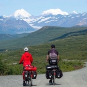
Cycling Whitehorse, Yukon to Anchorage, Alaska via Dawson City.Stage from Tangle LAke to Maclaren River following Denali Highway.One of the most epic cycling routes of the world. |
 The good weather from yesterday stays with us and since there is only a short stage ahead of us today, we can wait close to the coffee machine until the temperatures are in the double-digit range. After a photo on the Tangle River we are ready to go. The area around the Denali Highway has two watersheds: up to Tangle River sooner or later the water flows into the Copper River and further into the Gulf of Alaska, the area west of the Tangle River is drained into the Behring Sea via the Yukon River or flows over the Susitna River west of Anchorage into the Cook Inlet. In contrast to some other watersheds, the boundaries are not located on a mountain ridge but rather blurred next to each other. |
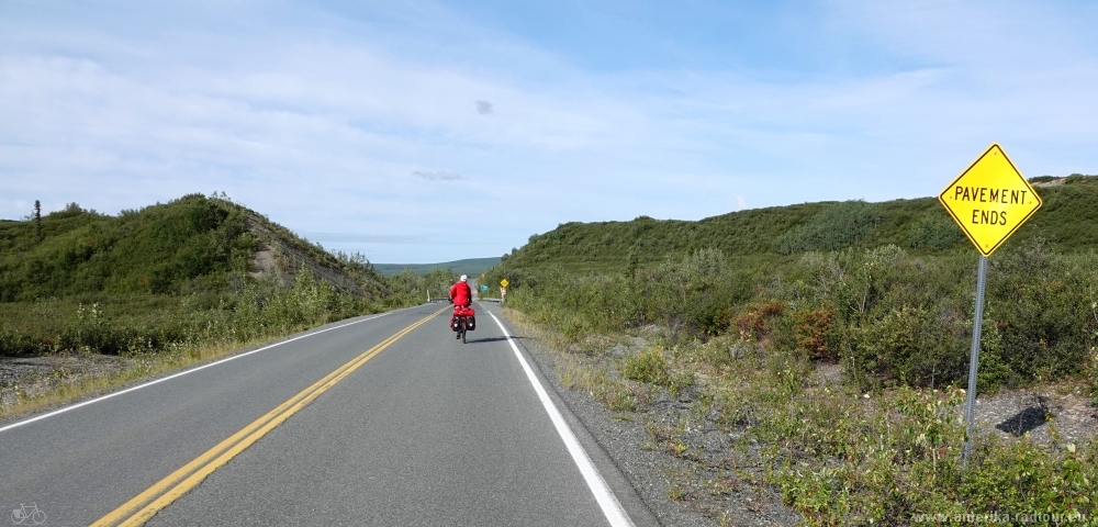 The paved section of the Denail Highway ends just a few kilometers west of Tangle River Lodge. From here to just before Cantwell, the road surface consists of gravel, whereby the road quality varies greatly. The Denali Highway was opened in 1957 and at that time it was the only access to Denali National Park, which was then still called Mount McKinley National Park. It wasn't until 1971 when the Park Highway opened that Cantwell got connected to the south with Anchorage and to the north with Fairbanks. |
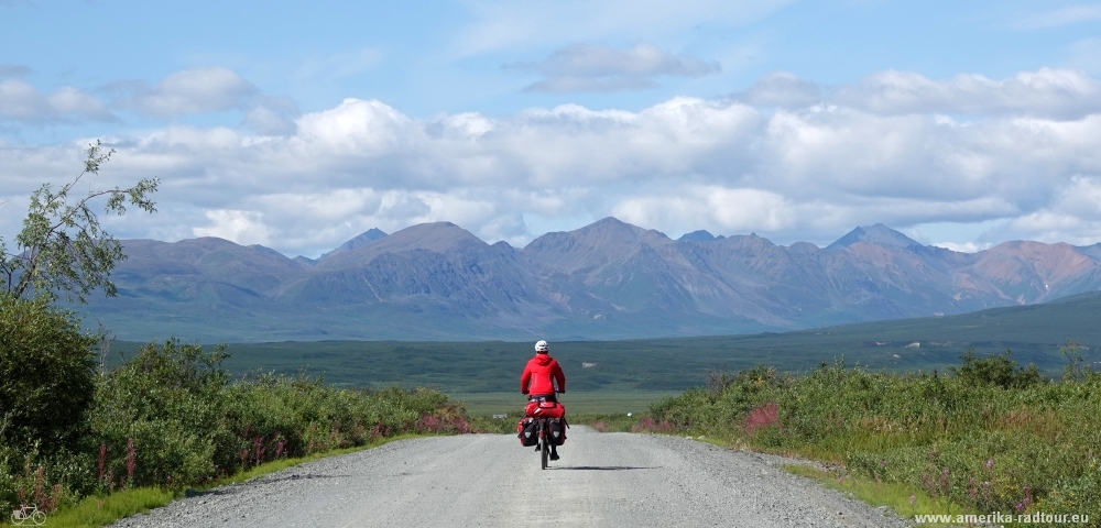
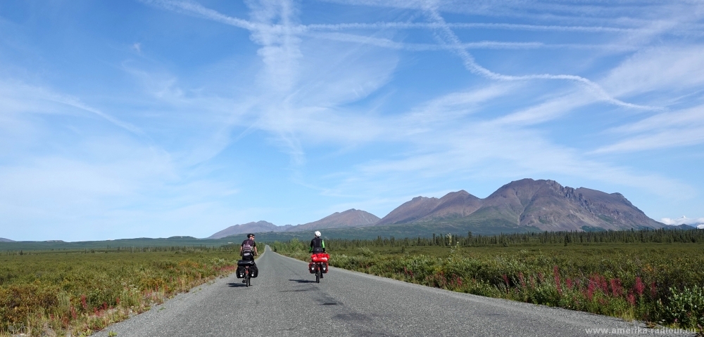 The Denali Highway leads us along the Amphitheater Mountains. The traffic is low, which is also due to the fact that most rental car companies prohibit driving their cars on the Denali Highway. |
 The snow-covered mountains in the background are up to 2000 m / 6500 ft high, the highway climbs slowly from 900m to an elevation of 1200m. Since the terrain is level to the left and right of the highway, the view extends to the mountains on the horizon. |
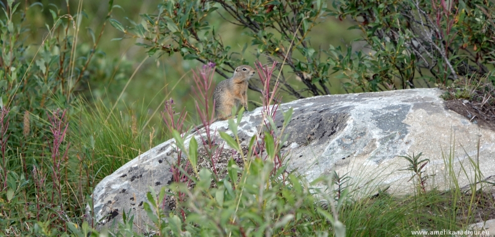 Here on the Denali Highway you should be aware of wild animals around you. While I'm taking a picture of this little rodent, a second animal comes running up and starts nibbling on my shoe. |
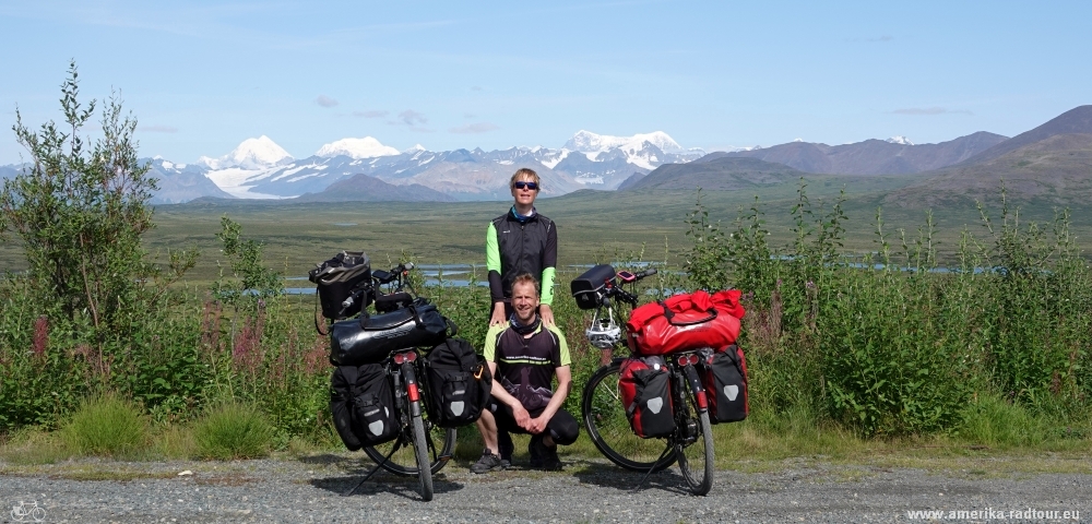
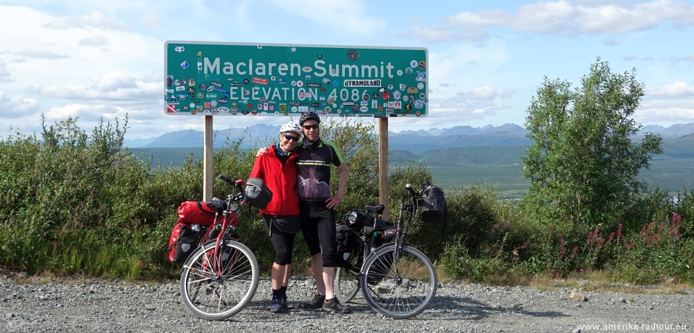 After about 25 km from Tangle River we reach Maclaren Pass, the highest point on the Denali Highway and with an elevation of 1245 m / 4086 ft the second highest pass in Alaska. |
 From Maclaren Summit it goes steeply downhill to the bridge crossing the Maclaren River. The incline is well over -5% over a longer distance, which is not so pleasant on the coarse gravel with heavily loaded touring bikes. On the sloping section we stop several times and enjoy the view of the southern foothills of the Maclaren Glacier, which is clearly visible between the sourrounding peaks. |
 Auch westlich vom Maclaren Summit ist das Gelände bis zu den Bergen der Alaska Range einzusehen. Die Aussicht wird durch die Tatsache begünstigt, dass der gesamte Denali Highway oberhalb der Baumgrenze verläuft. |